


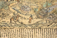

Comprehensive Map of the Sacred Landscape of Mount Wutai
Artist
Anonymous
Datedated May 10, 1846
GeographyChina
Mediumhand-colored woodblock print
(Ink and color on paper, some areas block printed.)
DimensionsPainting: 65 × 42 in. (165.1 × 106.7 cm)
ClassificationsPrints
Credit LinePurchase, 1964 (3202.1)
Object number3202.1
On View
Not on view

20th century